


On September 10,2008 – Wednesday, Dubai experienced a mild quake at around 3:10 PM. The intensity of the quake on richter scale was around 4.9. Even though the magnitude was not that severe, it caused a wave of panic among the residents of Dubai and northern emirates. The jolt felt much pronounced on sky scrapers around the region. The epicenter of the quake exists around 43kms west of the Qishm Island near Iranian port city of Bandar Abbas in the Arabian Gulf. The reason for the quake is due to a fault line on the Zagros belt on Iran.
The Zagros mountains are formed due to the collision of two tectonic plates – the arabian and Eurasian plates.(Refer Picture) The Zagros mountains exits around 1500 Kms in length on the border between Iran and Iraq. The Zagros mountains are playing a major role in trapping the fossil fuels and facilitating the oil richness in the region.
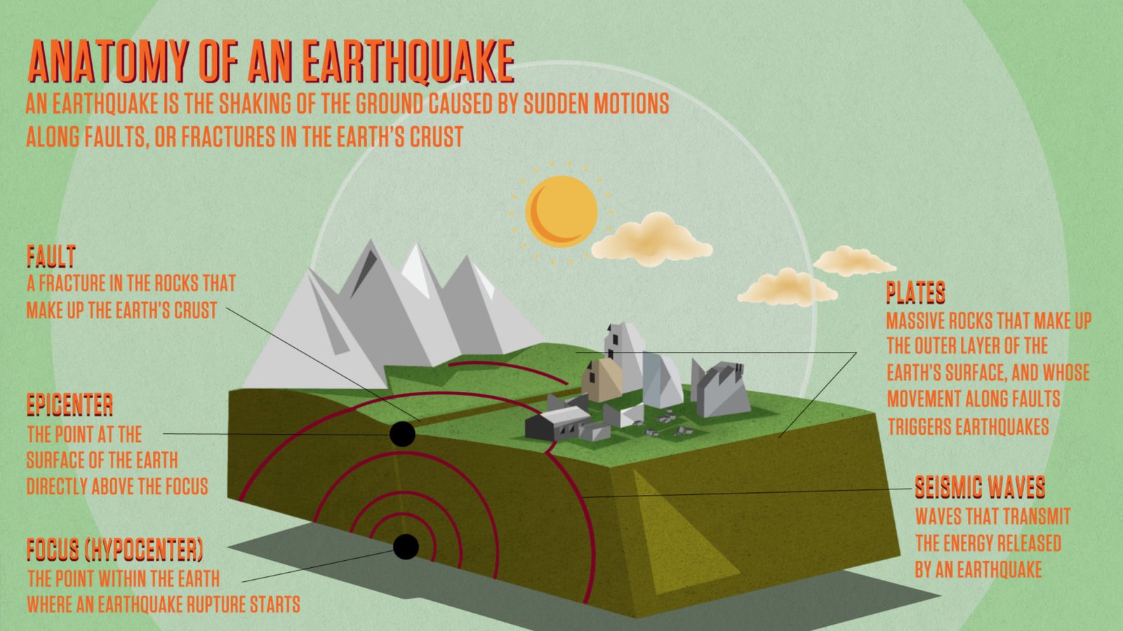
A question may arise here. What is meant by a fault?
The fault is a rock fractures which is showing signs of relative movement. These faults usually exists on the boundary of two tectonic plates.In this case arabian and Eurasian plates.
The reason for earth quakes, when narrated in laymen term, are due to the sudden release of energy due to the slippage of plates along a fault.
The arial photograph of Zagros mountain range is shown here.


These are some pictures showing a fault line on the mountain ranges.
Although Dubai is far from the active seismic zone, the reverberations were transformed into the three local faults lines which are located on Dibba (near Khorfaqqan), Wadi Hum and Bidya. Hence the reason for this quake.
The question to ponder is “Whether all the civic infrastructure in this region are designed to withstand a bit aggressive jolt……..?”


Comments